What do laser-equipped helicopters and mobile workforce platforms have in common? Turns out they’re both really useful in making sure high-voltage power lines and tree branches stay as far away from each other as possible.
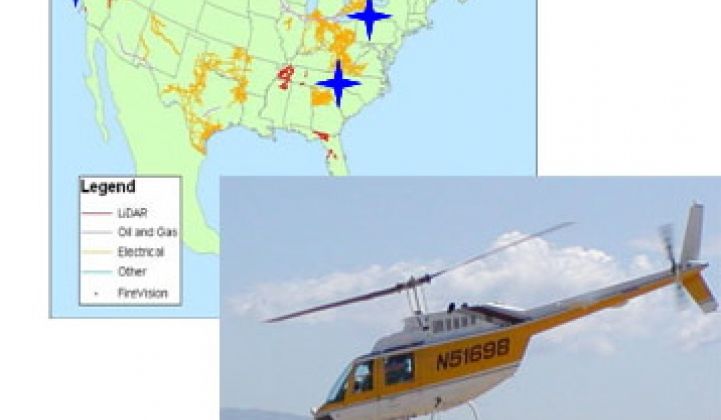
Call it “utility vegetation management.” It may not sound like a high-tech, high-growth line of work, but according to Hamilton, Ontario-based GeoDigital International, which uses LIDAR (light detection and ranging)-equipped helicopters to map out utility transmission corridors, it could represent a $600 million market over the coming years.
To capture more of that market, GeoDigital announced Thursday it was buying Powel Inc., the U.S.-based division of Powel, a Norwegian company that makes mobile workforce management platforms for the utility industry. Financial terms of the transaction weren’t disclosed.
The idea is to take GeoDigital’s high-tech maps of where utilities need to trim trees or upgrade power lines, and then use Powel’s platform to help workers in the field get the job done right, GeoDigital CEO Alastair Jenkins said in an interview.
“We’ve taken all that complex data and made it available to utilities,” he said. “The challenge then is, how can I manage that work?” With the Powel acquisition, “We can give the client an end-to-end solution.”
Think of it as a one-stop shop for dealing with the “trees, training and tools” challenges that utilities need to manage to prevent a repeat of the 2003 blackout that darkened much of the northeastern U.S. and southeastern Canada. That blackout was caused by overloaded power lines sagging into trees, causing the power lines to shut off, leading to a cascading failure of the entire regional grid.
That disaster led the Federal Energy Regulatory Commission to order utilities to undertake the massive task of inspecting, clearing and maintaining more than 450,000 miles of high-voltage transmission lines, Jenkins said.
Using LIDAR-equipped helicopters to create what Jenkins called a “complete 3D model at complete engineering-grade level” of every object along a transmission line’s path isn’t cheap. GeoDigital says the average cost is about $1,200 per mile for the initial flyover survey, along with periodic “re-flights” that cost $350 to $450 per mile.
Still, it’s a lot cheaper than sending out survey crews to drive those thousands of miles of power lines and take measurements, he noted -- and utilities are under pressure to get the work done. FERC’s rules require “urgent” re-rating of critical power lines in this year, and ask utilities to finish all 450,000 miles of lines by the end of 2013.
That’s led to a lot of new RFPs from utilities for the kind of service that GeoDigital offers, Jenkins said. The company had about 40 percent of the North American “vegetation management and transmission line re-rating” market as of last year, and has seen revenues climb from about $14.6 million last year to an expected $30 million to $40 million in 2011, he said.
Powel, for its part, has been supporting its fair share of transmission corridor work as part of its broader utility workforce management business, which represents about a $100 million market, according to company CEO Scott Rogers. The company’s platform allows field workers to access mapping and engineering data, document field work as it’s completed, prove to regulators that the work was done properly and keep up-to-date records to help maintain it over time.
“You can’t have a smart grid with dumb data,” Rogers said. “We provide the tools to the field users, who are not technologists, to document what’s going on out in the field.” Indeed, many smart grid players are working on mobile workforce connectivity, including Cisco.
Beyond the ongoing work involved in keeping transmission lines clear -- trimmed trees keep growing, after all -- GeoDigital’s LIDAR capabilities are also being used to plot new transmission corridors, as well as to map out wind farm and solar farm sites, Jenkins noted. Given the hundreds of billions of dollars of new transmission lines that will be needed to carry Midwestern wind and Southwestern solar power to the cities where it’s needed, that could be a big growth area as well.


 41
41
 15
15
 9
9