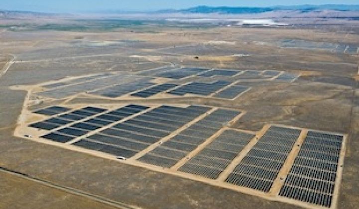
The forecast is looking better for getting more solar energy onto the grid and at lower cost, scientists at the National Center for Atmospheric Research say.
A team at the federally funded research and development center in Boulder, Colorado is embarking on a three-year project aimed at giving solar power plant and grid operators three-day forecasts that break down expected sunlight and power production by 15-minute increments.
“It’s critical for utility managers to know how much sunlight will be reaching solar energy plants in order to have confidence that they can supply sufficient power when their customers need it,” Sue Ellen Haupt, director of NCAR’s Weather Systems and Assessment Program and the lead researcher on the solar energy project, said in a statement. “These detailed cloud and irradiance forecasts are a vital step in using more energy from the sun.”
This isn’t the first instance of NCAR working to improve the ability of operators to maximize the amount of renewable energy flowing to the grid (while also minimizing the expense incurred for backup power from coal or natural gas plants). A few years ago, the center developed a wind energy forecasting system that boosted accuracy by 35 percent and allowed wind developer Xcel Energy to save $6 million in a single year, NCAR says.
The challenge with solar might be even greater, as it involves one of the trickiest tasks in meteorology: forecasting the cloud cover over a specified area.
"Solar energy output is affected not just by when and where clouds form, but also by the types of clouds present," explains NCAR. "The thickness and elevation of clouds have greatly differing effects on the amount of sunlight reaching the ground. Wispy cirrus clouds several miles above the surface, for example, block far less sunlight than thick, low-lying stratus clouds."
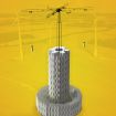
NCAR says it will marshal a full range of technologies, but “[c]entral to the effort will be three total sky imagers in each of several locations, which will observe the entire sky, triangulate the height and depth of clouds, and trace their paths across the sky.”
***
Editor's note: This article is reposted in its original form from EarthTechling. Author credit goes to Pete Danko.


 41
41
 15
15
 9
9