


Featured White Paper
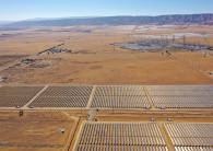
Leveraging CDI Technology for Grid Optimization and Resilience
Utilities and operators can leverage Veritone’s CDI technology for autonomous grid management, making clean energy production more predictable, efficient and cost effective, and accelerating the mission to end global dependence on fossil fuels.


